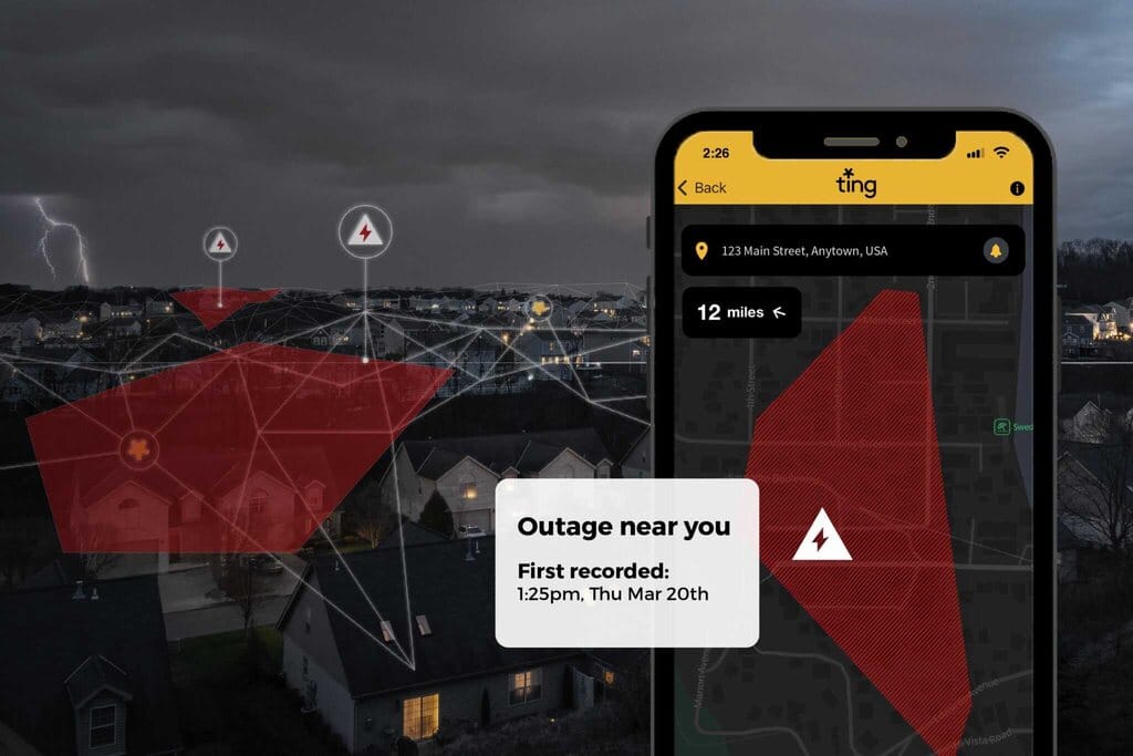
A new free tool that tracks power outages across the United States in real time is now available to everyone. Whisker Labs has added a national power outage map to its Ting app that provides immediate, neighborhood-level outage alerts and restoration notifications.
What makes this tool different is that anyone can use it – you don’t need to own a Ting sensor. The app lets users search for and save any address to receive alerts when power goes out and when it’s restored in that area.
“There’s never been an easy, accurate way for people to know exactly when the power goes out,” said Bob Marshall, CEO of Whisker Labs. “With this update, Ting becomes the first app to deliver real-time alerts to any home, for free.”
The service works through data collected from Whisker Labs’ network of 1.1 million homes with installed Ting sensors. These devices, originally designed to prevent electrical fires by detecting micro-arcing and sparks from faulty wiring, take 30 million electrical measurements every second – fast enough to notice voltage drops before a complete power loss.
When multiple sensors in an area stop reporting simultaneously, the system identifies a neighborhood outage. Whisker Labs claims that 95% of US homes have a Ting sensor installed within one mile, enabling street-level accuracy for outage detection.
The company decided to make this feature widely available after hearing how customers were using outage notifications to help their communities during power disruptions. During Hurricane Beryl in Texas last year, Ting users became information sources for friends and family about neighborhood power restoration.
More posts
This service addresses a growing problem. The US has experienced 60% more weather-related outages during summer months over the past decade compared to the 2000s. According to the US Energy Information Administration, Americans experienced an average of 5.5 hours of electricity interruptions in 2022, up from around 3.5 hours in 2013.
Traditional outage tracking methods often fall short. Utility company notifications can be delayed or inaccurate. After Hurricane Ida in 2021, New Orleans residents reported that utility maps showed power was restored in neighborhoods that were still dark. PowerOutage.us provides nationwide tracking but doesn’t offer the same neighborhood-level detail as Ting.
The new map could help people make better decisions during and after outages – like when it’s safe to return home after evacuation, whether to find alternative accommodation, or when to check on food safety in refrigerators.
The coverage of Ting’s map depends on its sensor network. Some users have reported gaps, with the app sometimes showing distant outages while missing closer ones that appear on utility company maps. These gaps may diminish as the network grows. State Farm has distributed 700,000 Ting devices to its customers and plans to reach 2 million homes.
The Ting app is available on both Apple’s App Store and Google Play. The interactive outage map allows users to save multiple addresses for monitoring, potentially providing peace of mind for people checking on distant family members or properties during extreme weather.
As climate change brings more severe weather and strains aging power grids, tools that provide accurate, real-time information about outages could become increasingly valuable for American households navigating the growing frequency of power disruptions.